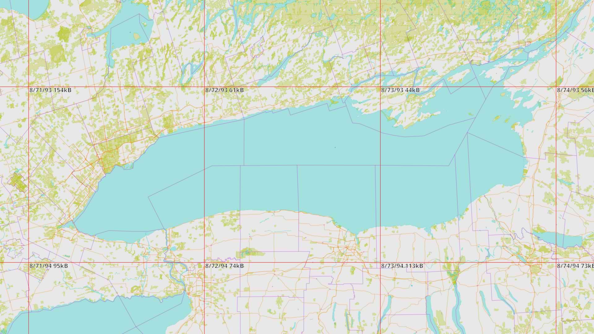
In a strange and purposefully inflammatory move, the United States government has decided they’d like to rename Lake Ontario to “Lake America”, once again affirming the Everyone is Twelve theory of modern American political rhetoric. Unsurprisingly, this schoolyard-bully-level move has been met with distaste from my fellow Canadians, including our own schoolyard bully Ontario Premier Doug Ford who quickly engaged his core competency and erected a large sign reading “Lake Ontario: Now and Always”.
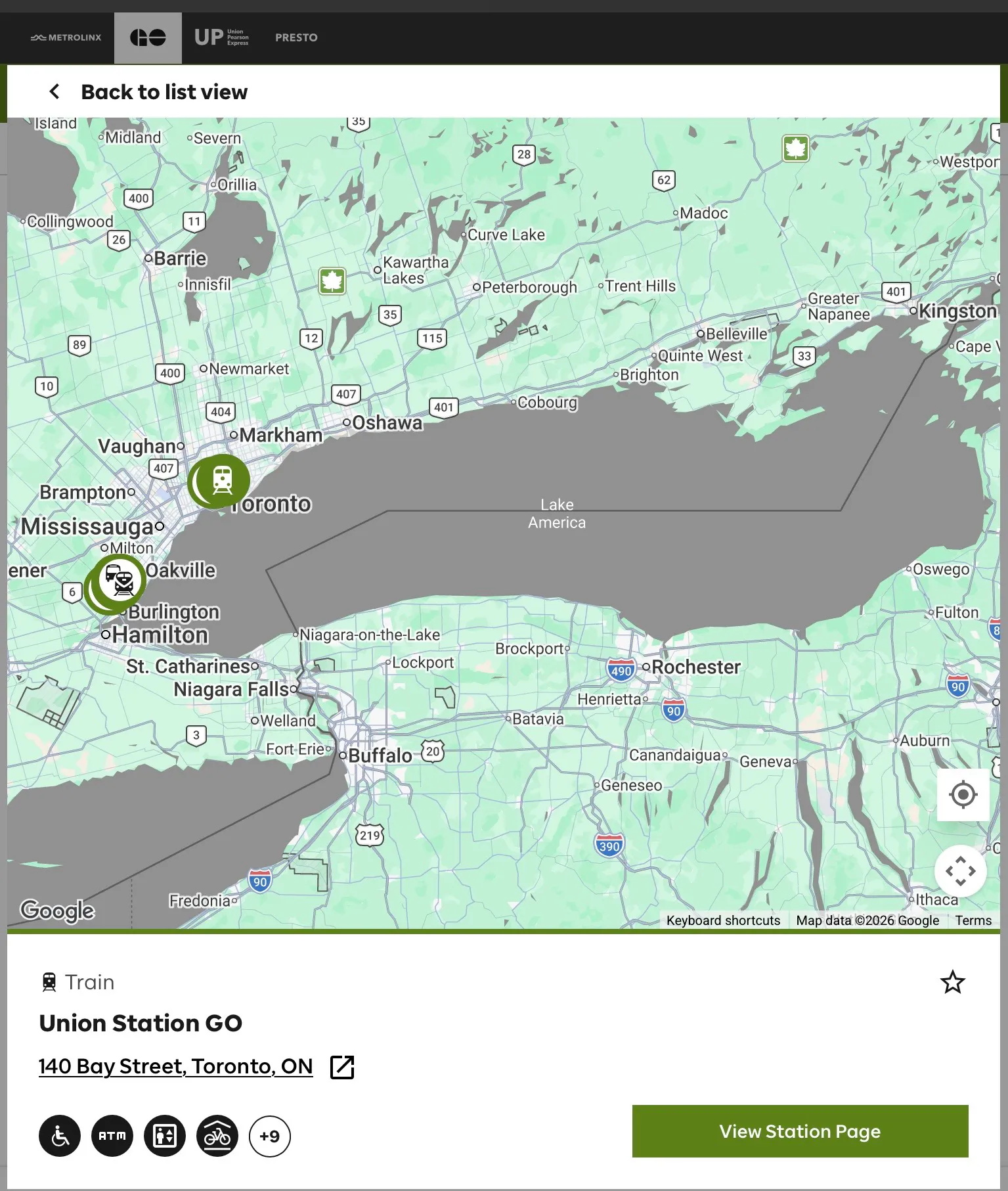
Eggs were quickly on faces however as our government websites1 soon began to display “Lake America” anyways, because (like most of the world), we’ve outsourced our consumer geospatial services to our neighbours down south, more specifically to Google.
Google Maps and Territorial Disputes
Maps are both utilitarian and political in nature; they help us navigate the world, but also serve to communicate the boundaries of nations and their power. Making a single shared map of the world sounds great, until you realize that you’ve essentially signed up to moderate actual wars and any errors you make can lead to new ones.
Like any good corporation, Google wants no part of that liability, so they have enacted a fairly simple technical solution to this social problem: serve different maps based on the country the user is in. While Google follows America’s GNIS name change within the United States, it still renders the lake as “Lake Ontario” in Canada. The rest of the world gets “Lake Ontario (Lake America)” which, according to Google, “follow[s] our long-standing policy for bodies of water with names that vary from country to country” — a convenient policy to have when you need to wash your hands of a controversy.
In the case of the aforementioned government websites, the fix is pretty easy. Previously the site operators either didn’t specify a region code in their embed URL or used region=US. Switching to region=CA will always show “Lake Ontario”… At least for now. If you need to change this behaviour on your website today, more details are available on Google’s map embedding documentation page.
Do Not Obey in Advance
“Oh! A long standing policy, well that settles it, wrap it up!”
Maybe it’s just because it’s my country this time, but I don’t feel like letting Google off the hook that easily. I’ll concede that localization which respects the user’s reality is the right solution, but where this faux neutrality angle really falls apart for me is when America, the country with real regulatory power over Google, is also the one pushing the geopolitical agenda. Sure Canadians are placated for now with “Lake Ontario” on our maps, but when the rest of the world gets “Lake America” in brackets, the American administration’s hyperstitions take a big step forward toward our shared reality. It’s not a big leap to assume that Google would also comply with an executive order demanding that American geospatial data providers align with American interests when serving maps abroad.
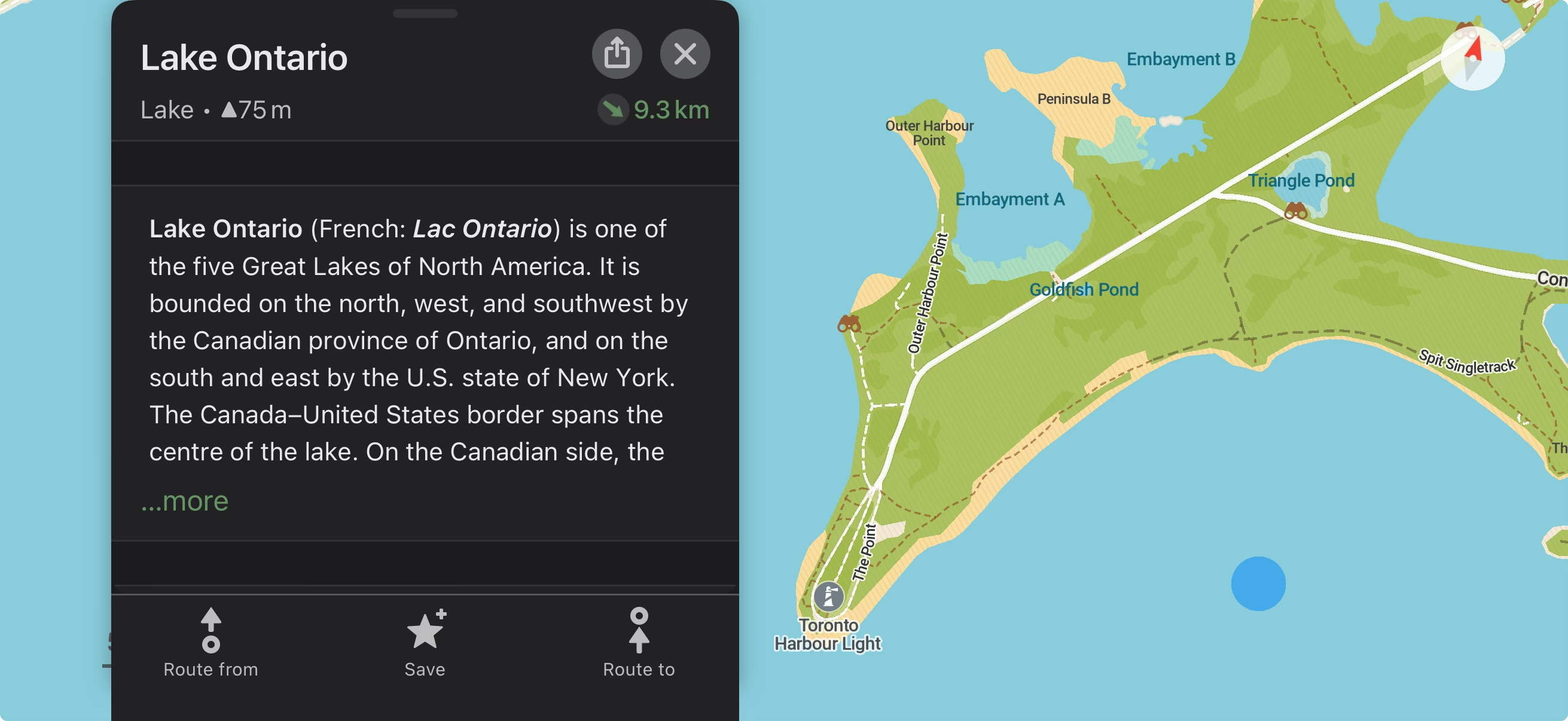
Before we get into the latter half of the post, I think it’s important to acknowledge that there is no single drop-in replacement for everything Google or Apple Maps offers today. Points of interest, real-time traffic insights, and reviews are all complex features and valuable data that you shouldn’t assume all competitors will have implemented. With your expectations adjusted, if you’re looking for a great free and open-source alternative, I highly recommend trying CoMaps! It’s far from a direct downgrade too, I’ve found that CoMaps typically has better outdoor maps for hiking trails and urban details like hidden pathways that you won’t find on common commercial apps.2 It also works completely offline!
Self-Hosting Your Own Map Tiles
Hosting digital map tiles used to be a pretty involved back-end endeavour, but in 2026 it has never been easier, largely due to OpenStreetMap (OSM) and Protomaps.
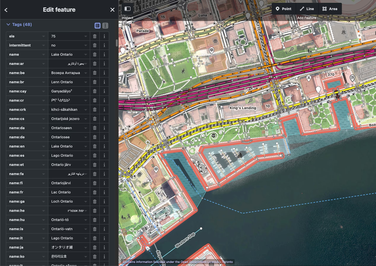
With Google Maps, one outsources both the data collection and rendering responsibilities to Google, OSM on the other hand mostly functions as a database that other mapping applications can use to render the parts of the dataset they want. Like Google Maps’ dataset, in the case of “Lake America”, OSM currently has Lake Ontario mapped with the following English name-related tags:
name="Lake Ontario"name:en="Lake Ontario"official_name:en-US="Lake America"
Unlike Google Maps however, YOU have control over the rendering and can simply choose to ignore America’s declared official name!
Protomaps takes OpenStreetMap exports and compiles them to an efficient vector format that can be served as a static .pmtiles file on pretty much any web server. Regular builds of the entire world take up ~128GB, but you can extract a section of the full planet so you don’t have to pay to store the full thing.
Besides some very elegant file format engineering, the real technology powering Protomaps is HTTP range requests, a clever part of the HTTP spec that allows your browser to request specific parts of a file from a web server. As a result, users of your site won’t have to download the entire 128GB map of the world, they will only download the specific areas they want to view! TL;DR, it’s likely substantially cheaper than whatever you are currently paying for via Google Maps’ API.
There are some good reasons not to choose Protomaps3 but for most websites that just need to show a pin next to an address and give users some location context, I think it’s a slam dunk. If the digital sovereignty angle of self-hosting isn’t connecting with you but you still want to switch out Google Maps for OSM, check out OpenFreeMap — a great free tile server with attractive themes.
In Summary
Our government talks big game about digital sovereignty, and this is one example of what you lose when you give it up. I think Canadians (most of the world really) have developed a sort of learned helplessness when it comes to reliance on big tech services when there are viable and even superiour alternatives, they just require a little more legwork. Fortunately, computers are only getting easier to use and coding agents have made solutions like Protomaps dramatically quicker to implement. Do a little research before adopting the same default dependencies on your next project, you might be surprised at what’s out there!
Let the online map revolution begin!
Footnotes
-
From what I’ve seen, this also applies to a lot of small businesses that have map embeds too. ↩
-
CoMaps uses OpenStreetMap for its map data. ↩
-
If you need some more: It’s only a replacement for map tiles, not routing, reviews, geocoding, POI databases, etc. Maybe the biggest tradeoff is that you’re responsible for updating the map! Lets be real though, it’s not that hard to replace a file with a new one every few years :) ↩